

March 28, 2022

Steve Adams
Product Marketing Manager
Geospatial Intelligence is the analysis of location imagery and information to assess and analyze physical features and geographical activities on the Earth. Geospatial OSINT is the collection and analysis of publicly available geospatial data. Location-based intelligence is the analysis and visualization of geospatial data, which can provide get situational and environmental awareness to better understand or protect locations and events.
Geospatial OSINT techniques are conducted by government agencies, law enforcement agencies, and private companies, with research conducted by investigators, analysts journalists, and researchers. Geospatial OSINT techniques can be applied during investigations to assist in the location of suspects and missing persons and research global events like pandemics and natural disasters.
When conducting large-scale geospatial analysis, a geospatial intelligence platform is generally required to capture all of the relevant data. However, geospatial analysis can be conducted manually against individuals and one-time events to inform decision-making.
In this article, we will outline resources that can be utilized to manually collect and analyze geospatial data during internet investigations.
This is an introduction to geospatial OSINT Investigations. To view the full webinar, click here. To download the guide, which includes advanced techniques and analysis, click here.
Mapping Solutions
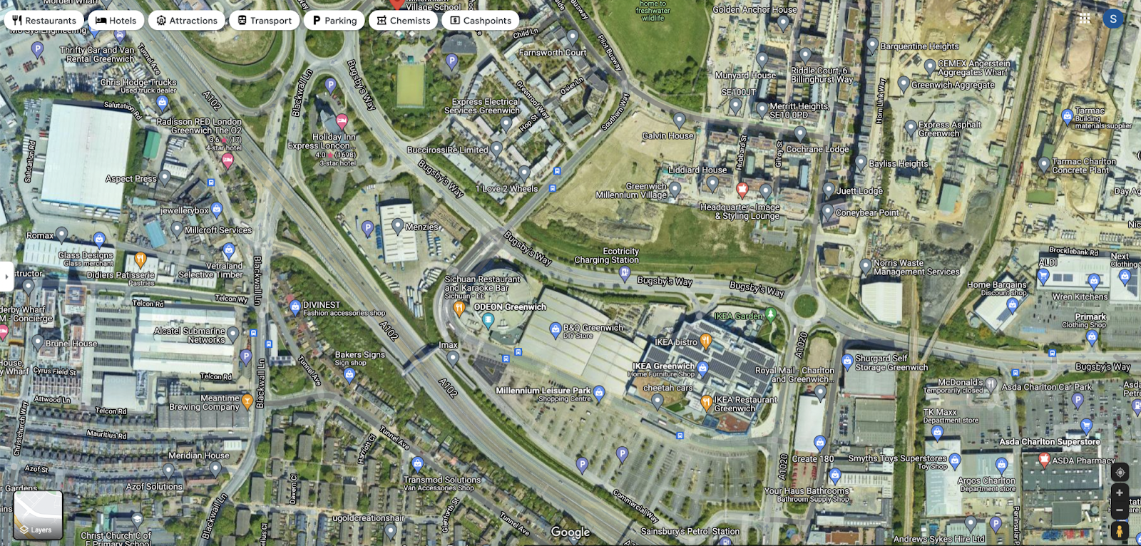
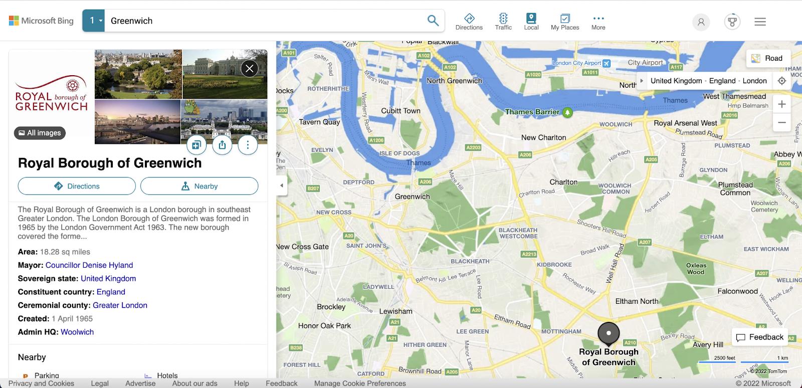
A range of mapping solutions that provide both satellite imagery and street view interactive panoramas are available to assist in location analysis. Looking at Greenwich Millenium Village in Central London, UK, some of these solutions are outlined below.
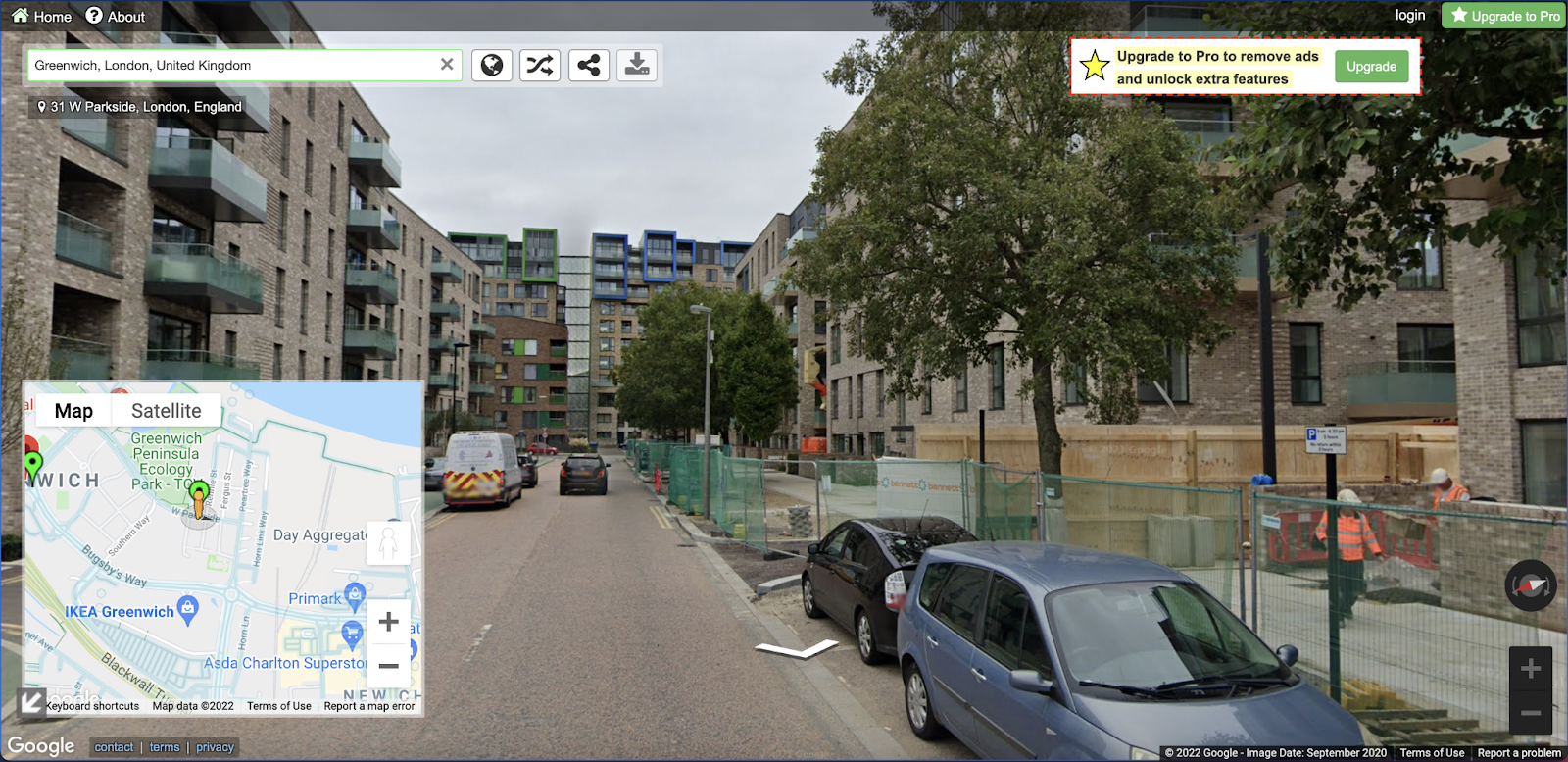
Google Maps - https://www.google.com/maps
Google Maps is a web mapping platform provided by Google. Google Maps offers satellite imagery, aerial photography, street maps, panoramic views, real-time traffic, and route planning.
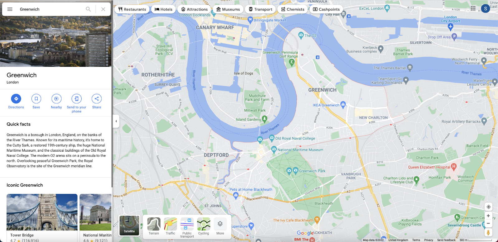
Clicking the ‘Layers’ button a single time will open up satellite imagery of the location at the time that a Google accessible satellite most recently captured the location.
Google Maps also has Street View, which enables interactive panoramas from positions along many streets in the world. The majority of Street View imagery was captured by cars equipped with Street View cameras.
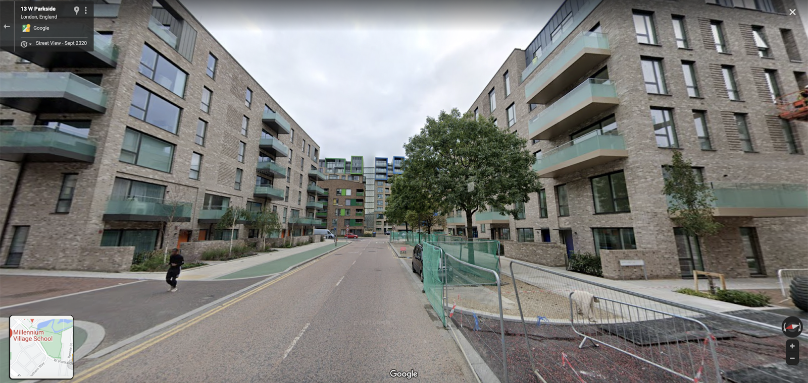
Within Street View, if previous imagery for the same location exists, it can be viewed by clicking the date in the top-left corner of the image. In the image below, this shows the development of buildings along the street, which are complete in the image above.

Google Earth Online - https://earth.google.com/web/
Google Earth Online is another Google geospatial tool that provides worldwide satellite imagery and 3D buildings and terrain. This browser version of Google Earth offers standard print screen resolution images.
The search bar can be found by clicking the magnifying glass logo on the bar on the left-hand side of the screen.
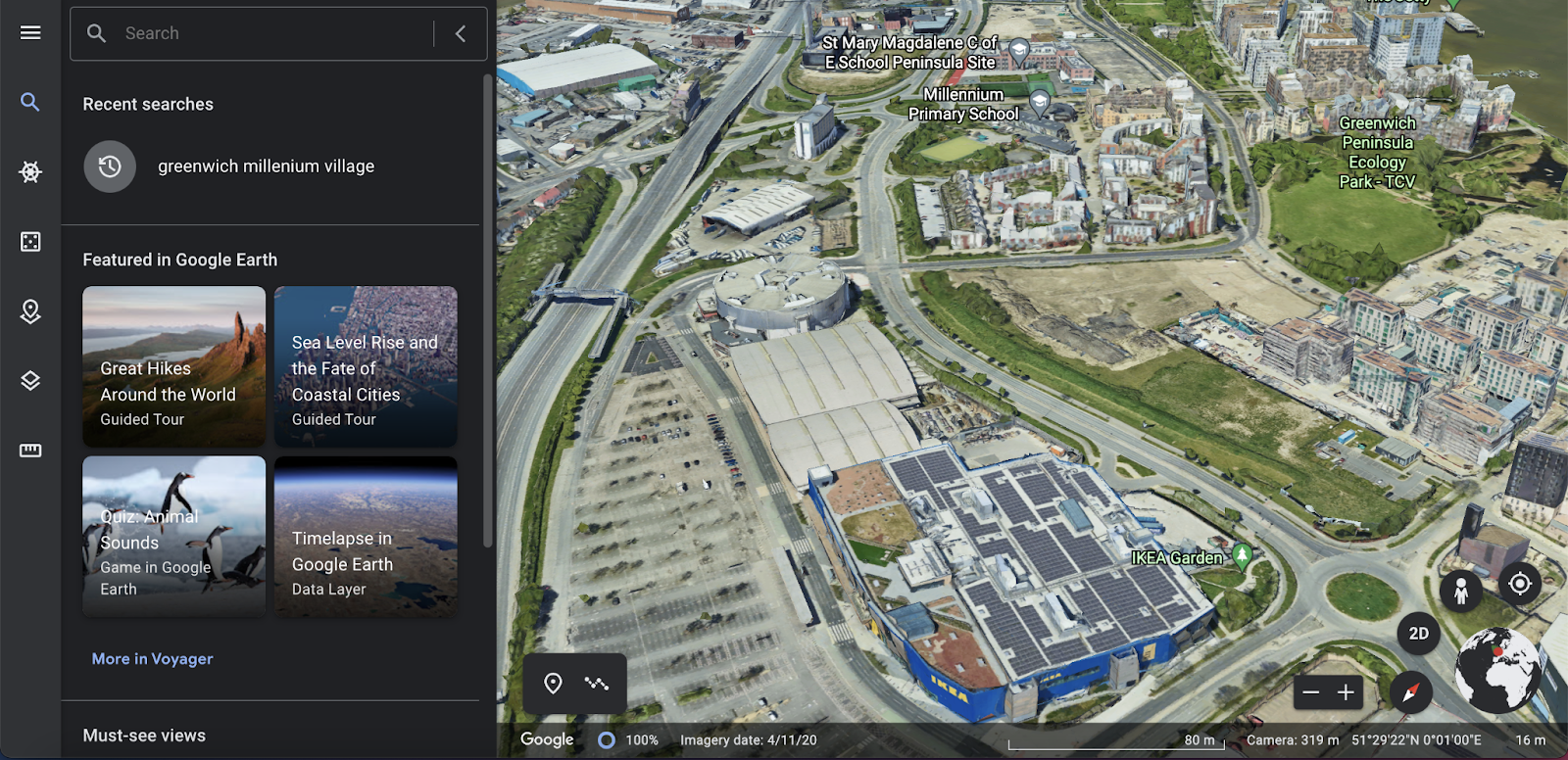
When zoomed in to street level, locations appear ar 3D imagery, showing the height of buildings and landmarks much better than satellite imagery.
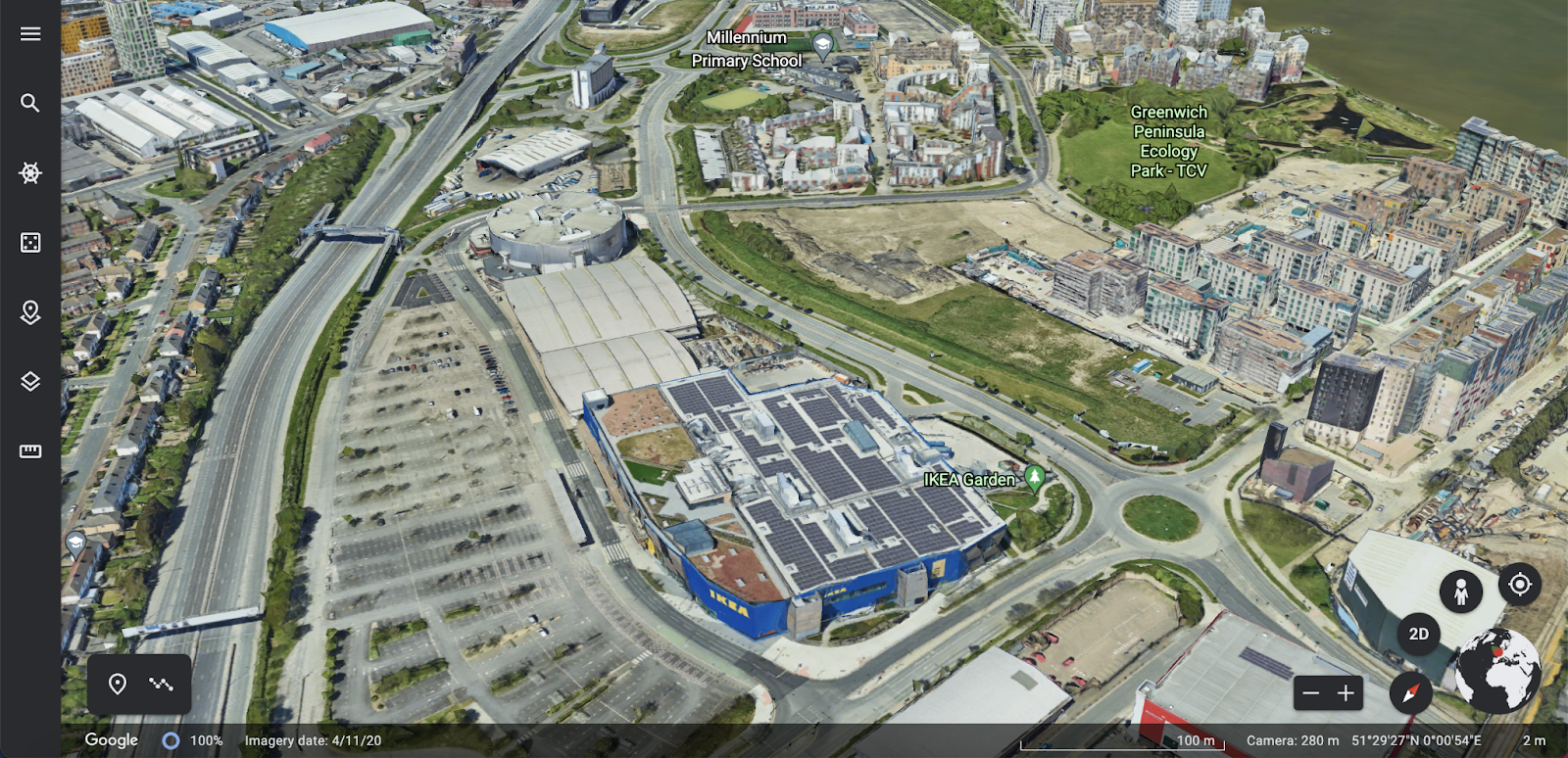
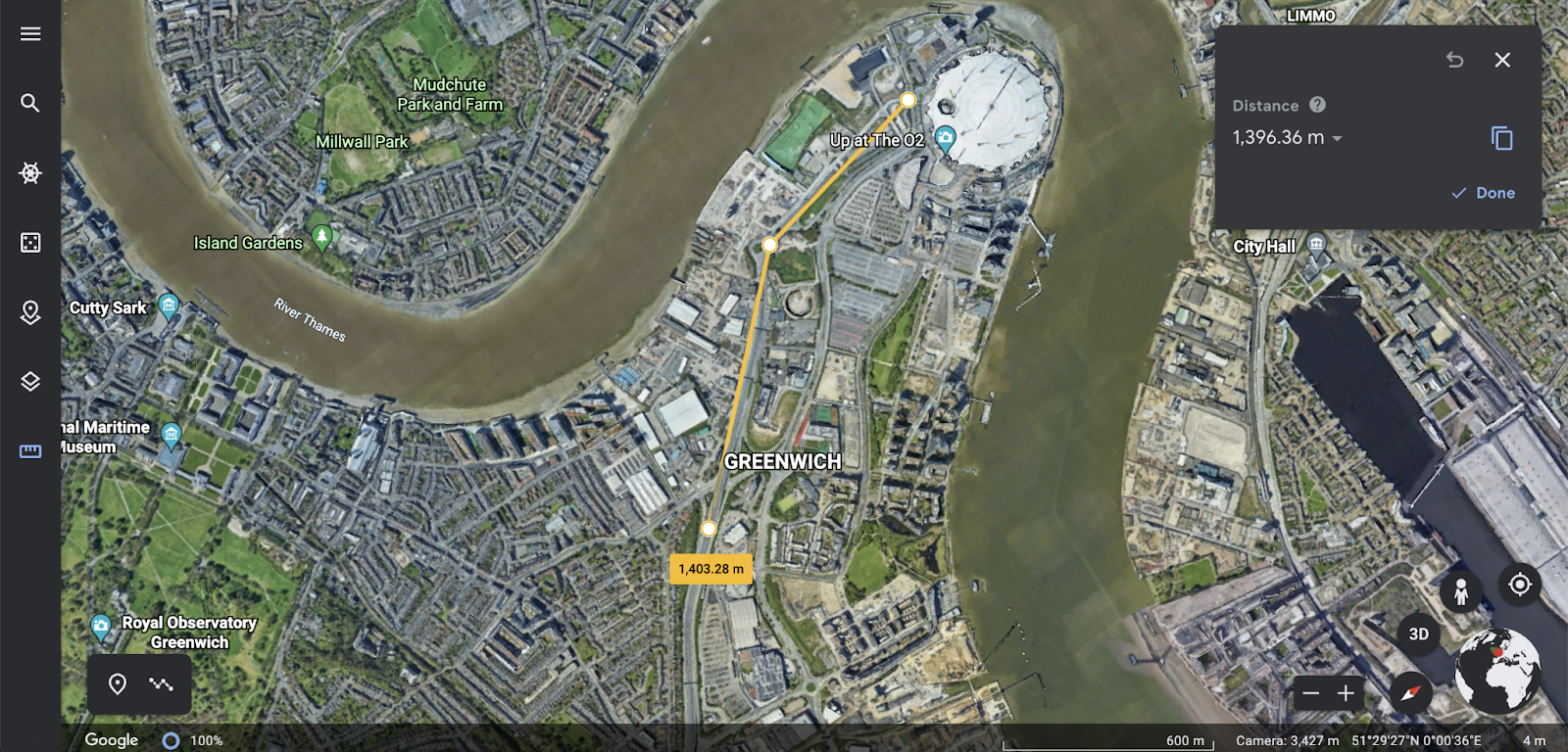
Zooming out will show satellite imagery, similar to Google Maps. Clicking the tape measure button in the menu, you can measure distances, enabling you to calculate the distance between locations relevant to your investigations.
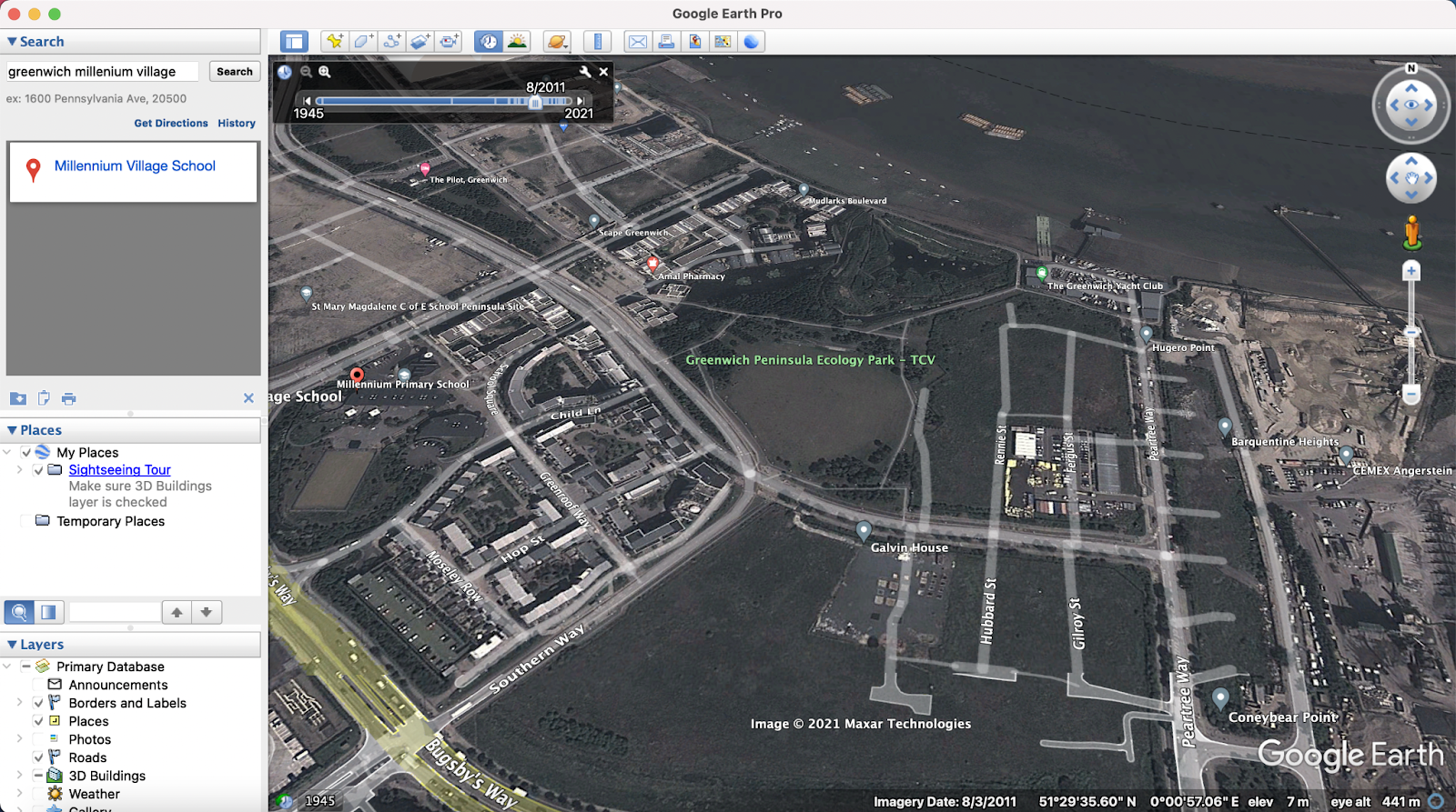
Google Earth Pro Platform - https://www.google.co.uk/earth/versions/#download-pro
Google Earth Pro is a downloadable geospatial software application that displays a virtual globe, which offers the ability to analyze and capture geographical data. The Pro version of Google Earth Pro offers premium higher quality resolution photos. Google Earth Pro uses the same imagery as the free version of Google Earth. However, Google Earth Pro offers additional tools designed for business users like measuring areas of polygons or circles, mapping multiple points at once and additional demographic, graphic, and traffic data layers.
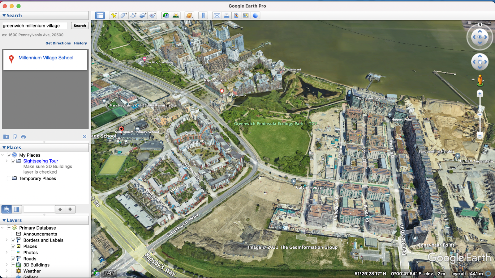
Google Earth Pro also offers another tool unavailable in the browser version of Google Earth, historic satellite imagery. Clicking on the date button in the bottom left of the map, a timeline will appear in the top left-hand corner of the imagery. Clicking within the timeline will change the date of the satellite imagery, which enables investigators to view a location throughout time. This is particularly useful for investigations that focus on areas impacted by war and global disasters.
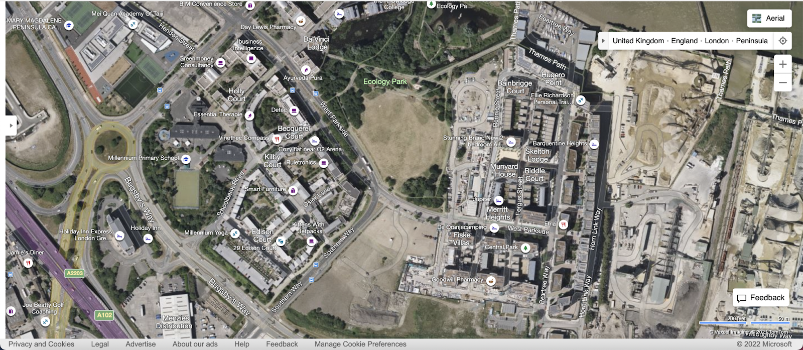
Bing Maps – https://www.bing.com/maps
Bing Maps is a web mapping service provided as a part of Microsoft's Bing suite of search engines that provides aerial imagery, street maps, and directions.
Clicking on the ‘Road’ button in the top-right corner provides a list of mapping layers, including ‘Aerial’, which provides satellite imagery.
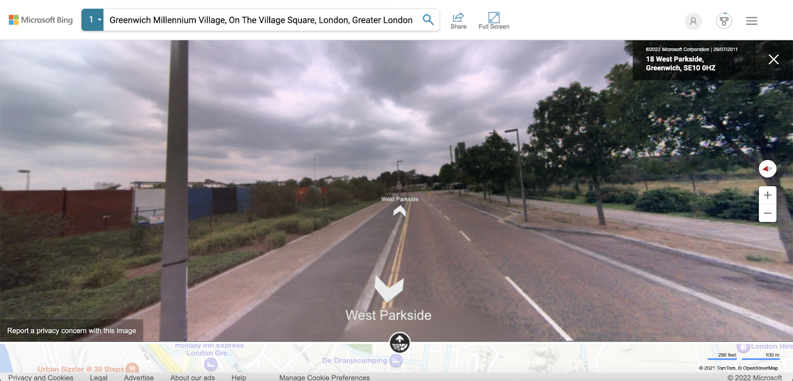
Another layer option in the list in ‘Streetside’, shows an interactive panorama at street eye level. In the case of Greenwich, Bing’s street view is much less recent than Google’s and shows 2011, which therefore shows none of the recent development work that has been captured by Google.
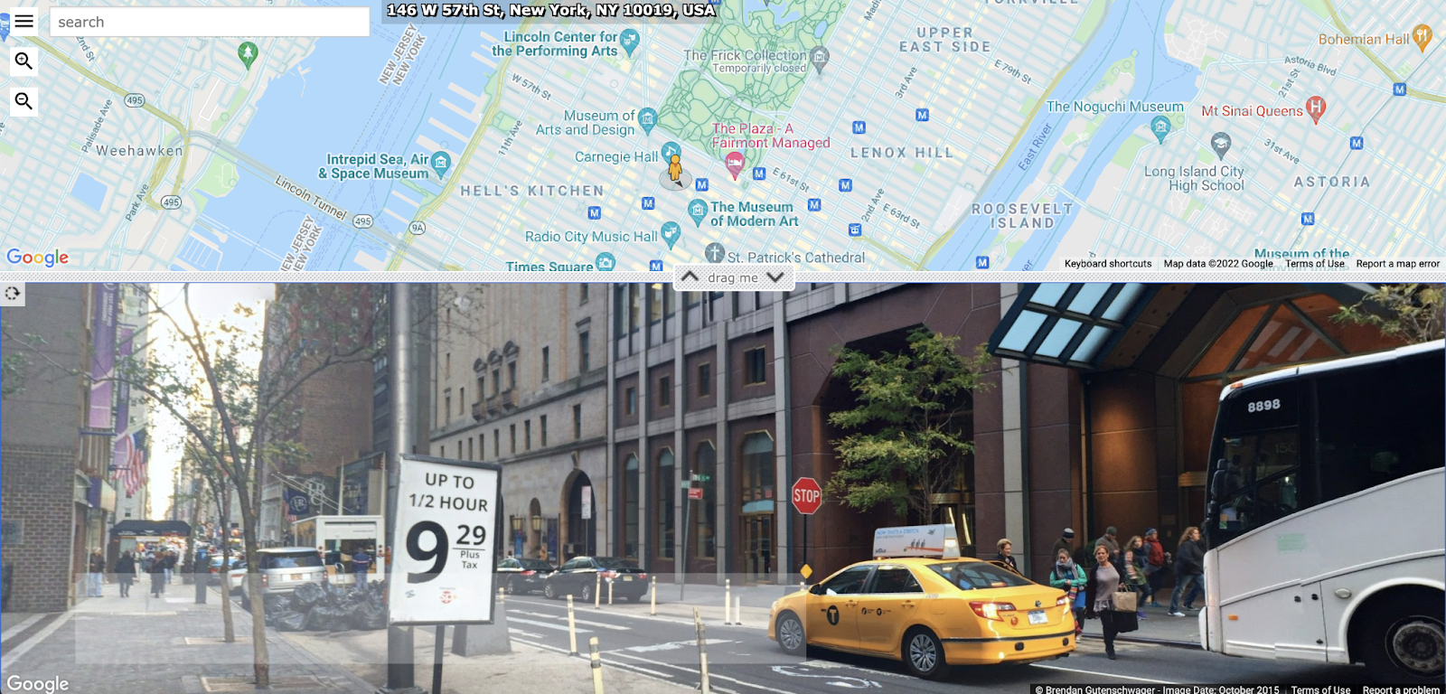
Instant Streetview – https://www.instantstreetview.com/
Instant Streetview is a platform that enables users to instantly see Google Street View for any supported location. Providing the same Street View imagery as google, Instant Streetview provides no additional functionality and doesn’t offer the same access to historic Street View imagery but does make accessing current street level panoramas quicker.
Show My Street - https://showmystreet.com/
Show My Street is an alternative to Instant Streetview that enables users to instantly see Google Street View for any supported location.
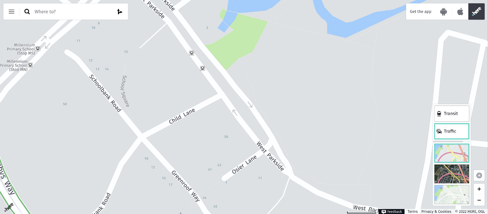
HERE WeGo - https://wego.here.com/
HERE WeGo is a navigation platform designed for providing directions. Whilst designed for identifying optimum travel routes, HERE WeGo’s standout feature for investigators is that it often provides house numbers within the map. Looking at specific streets in Here WeGo, you can usually see the house numbering system for the nearby residences, which assists planned operations like surveillance and arrest attempts.
Mapillary - https://www.mapillary.com/
Mapillary is a service for crowdsourced geotagged photos that allows members of the public to upload their own imagery of locations. Looking at the platform, any area with a green line shows an area that users have submitted location imagery for.
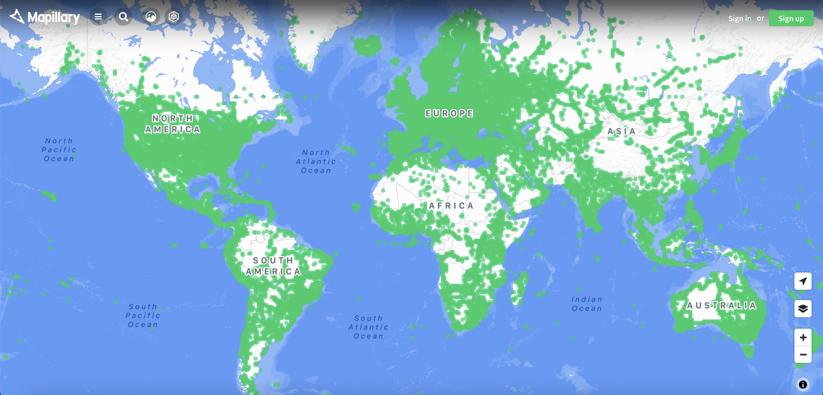
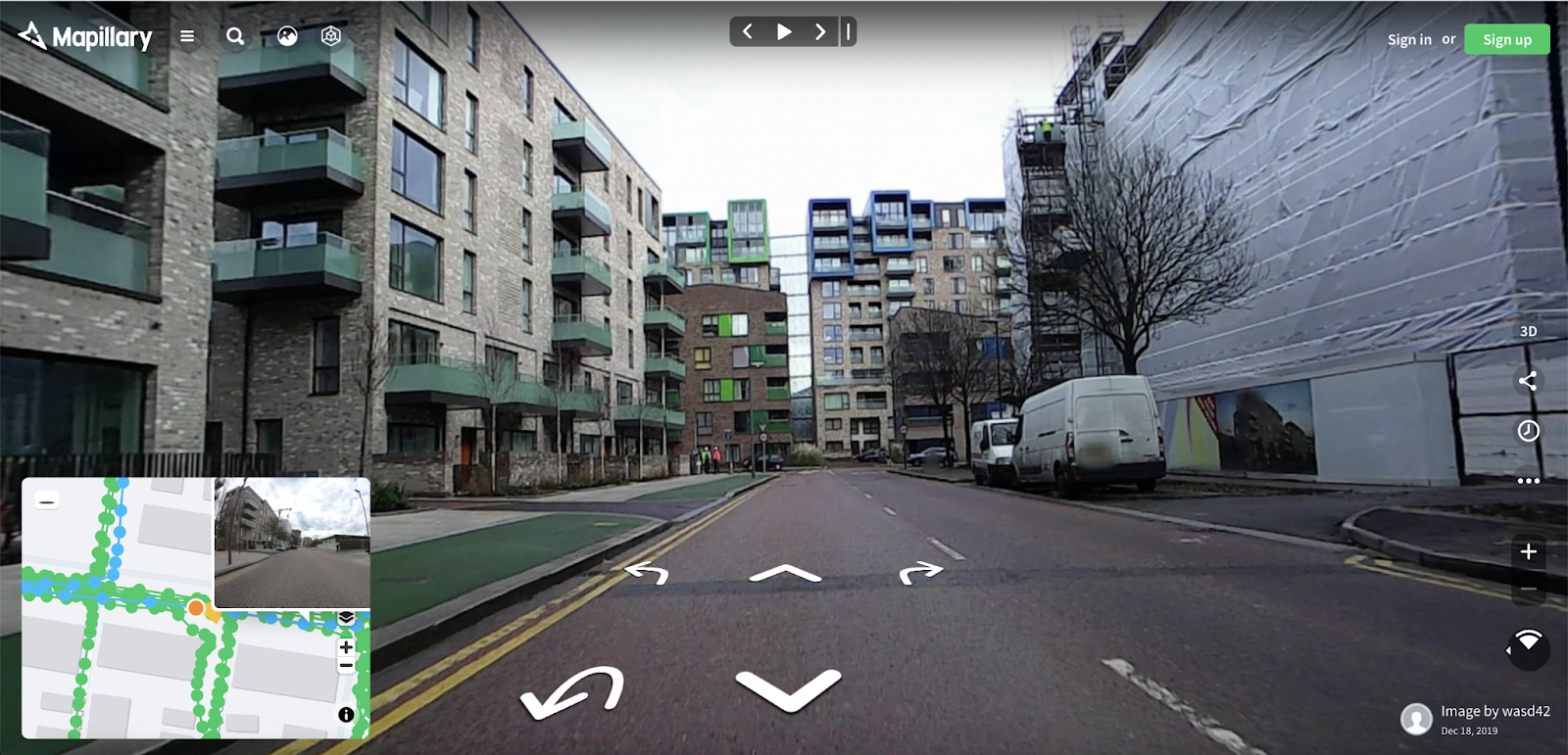
Zooming in to the North Greenwich area, you can click on any area covered in green to see the submitted view. After clicking a green dot, a new sub-window will appear, showing the street level view. To enlarge the view, click on the arrow in the top-right corner of the street view window, which will swap the street view and map windows.
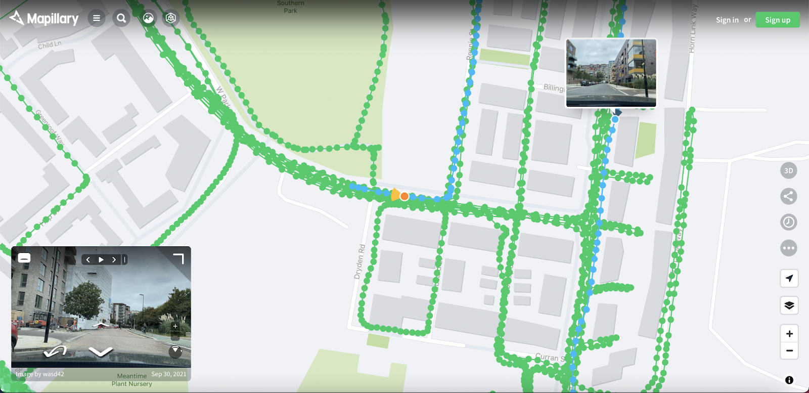
Mapillary is less interactive than other street view options, so to turn around you will need to click the arrow pointing behind the current view.
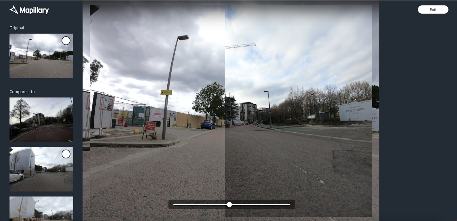
Clicking on the clock symbol on the right-hand side of the screen, open up the ‘Time Travel’ feature. Time Travel enables users to view two versions of inputted data for the same location at once. To control Time Travel use the slider bar at the bottom of the image.
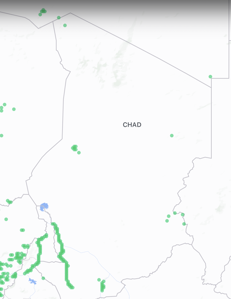
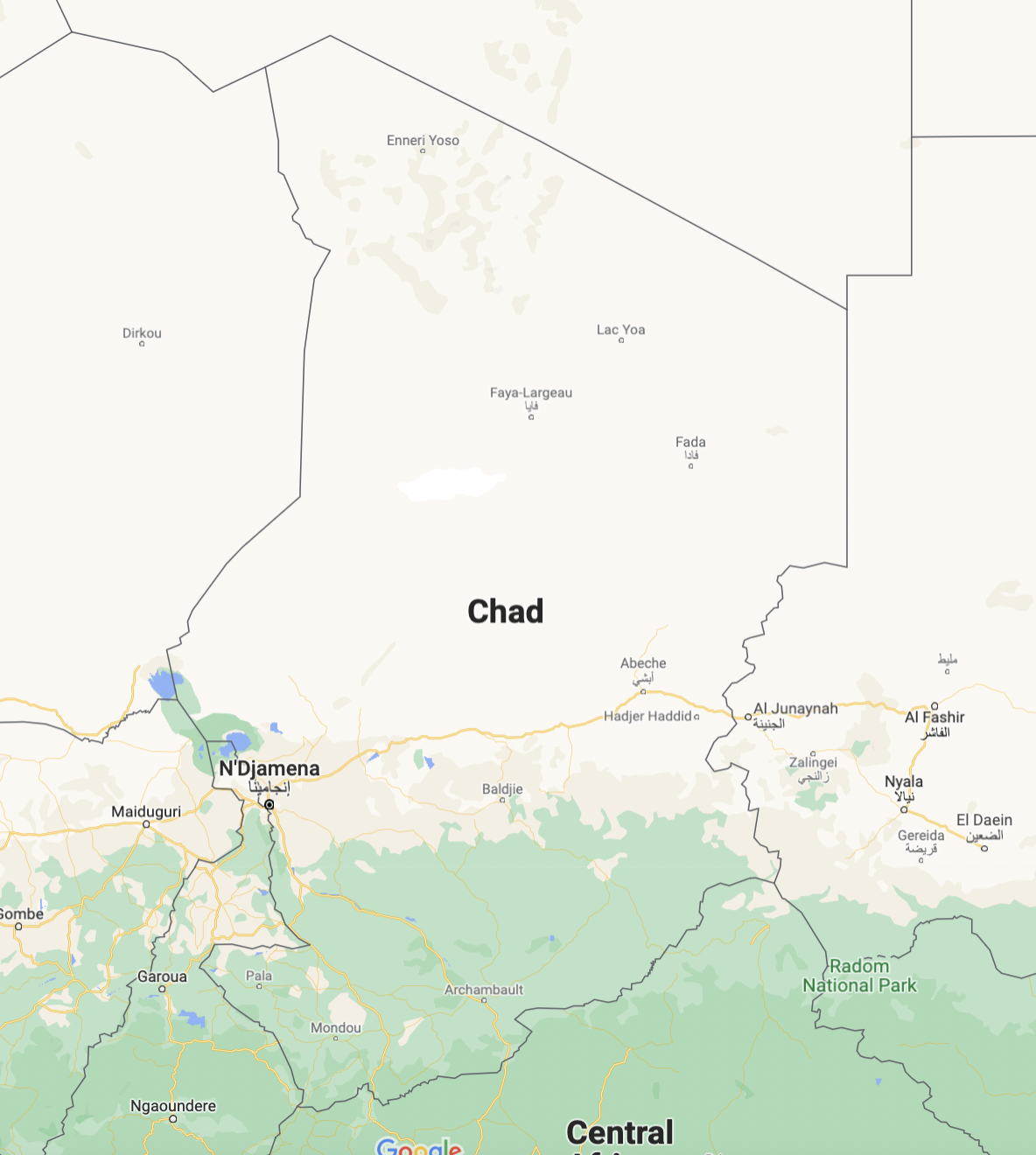
Mapillary is particularly useful for investigations focussed on countries less likely to be traversed by Google’s own vehicles. When comparing Chad on Mapillary and Google, user-submitted data is available on Mapillary where none is available from Google.
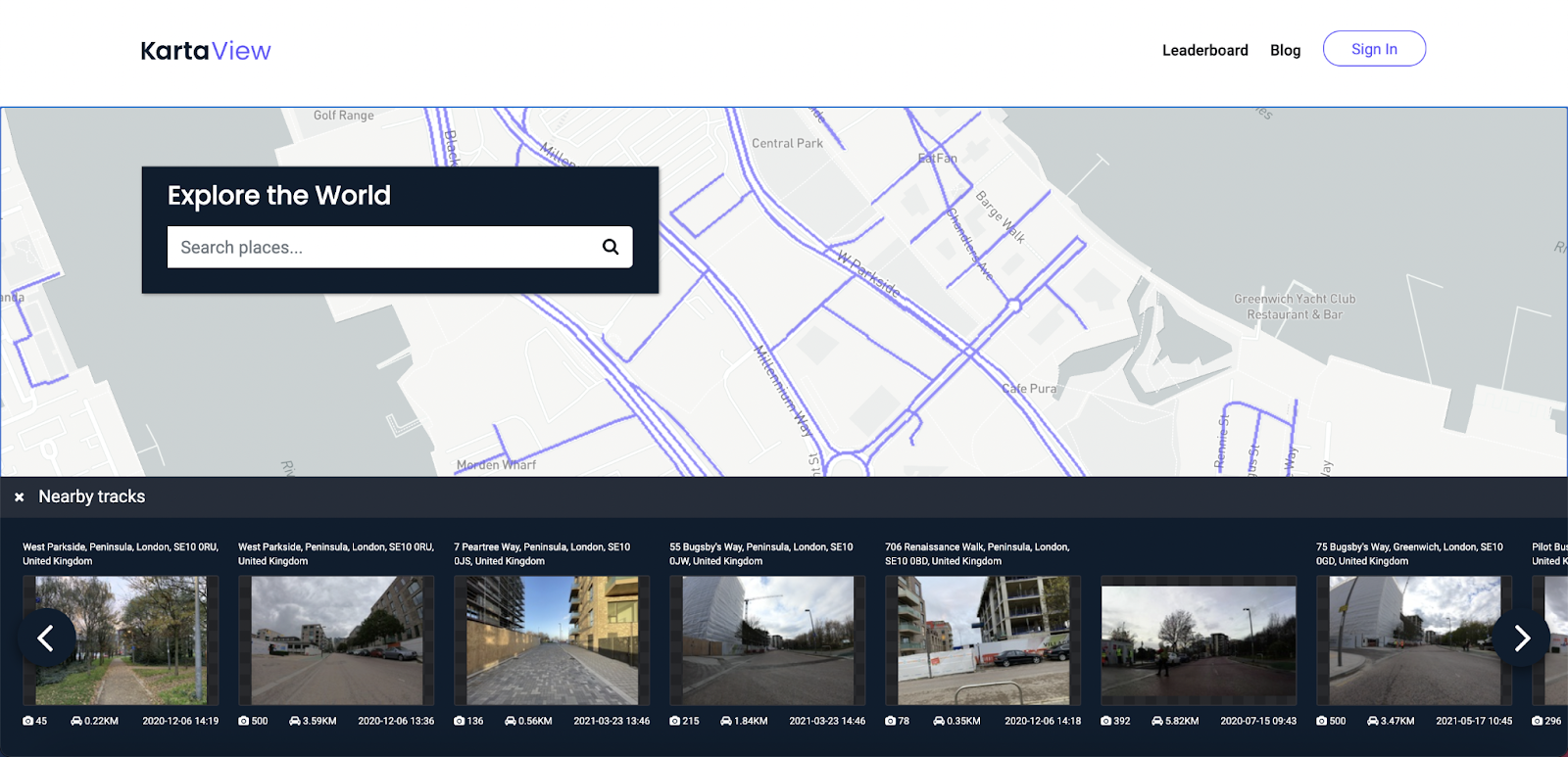
Karta View - https://kartaview.org/map
KartaView is another platform for street-level imagery that enables users to contribute their images of a location.
Locations can be searched in the search bar. To view a location, click the purple line on the map at the desired location, which will present available options for the location.
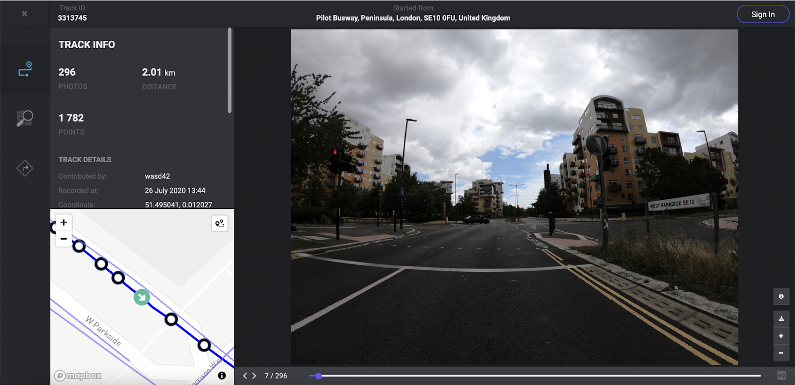
Clicking on any of the ‘tracks’ will show you relevant details and enable you to view the submitted imagery.
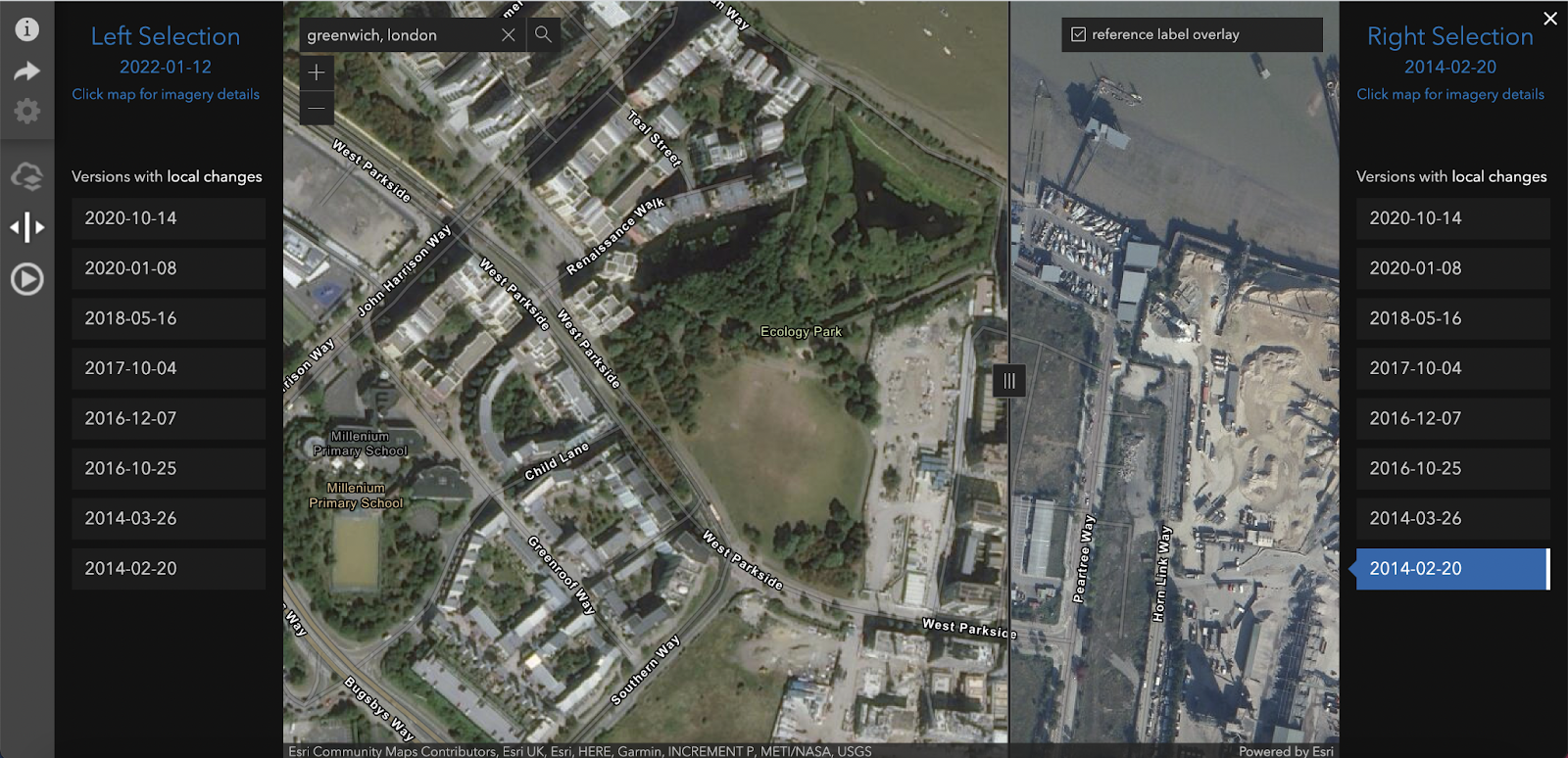
World Imagery Wayback - https://livingatlas.arcgis.com/wayback/
World Imagery Wayback is a digital archive of the World Imagery base map, enabling users to access different versions of World Imagery captured over the years. World Imagery base map provides users access to over 100 different versions of satellite imagery. Using the timeline on the top-left corner of the page, users can navigate the imagery layers to view changes over time.
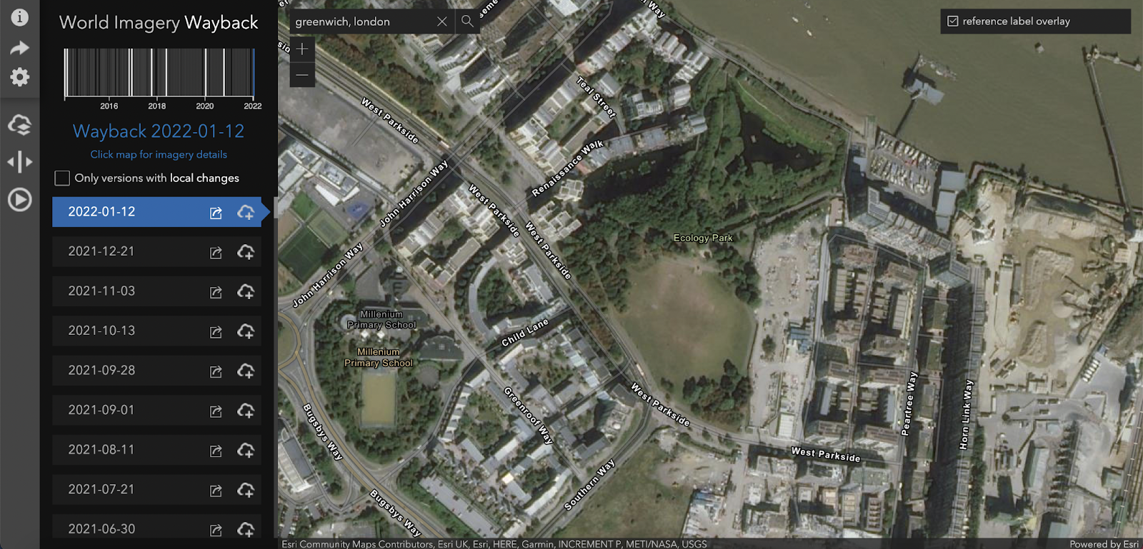
Hitting the ‘Toggle Swipe Mode’ button in the left-hand menu, users can view two different layers at once on the screen to easily compare any differences. A button in the middle of the bar separating the layers enables users to view more or less of each image.
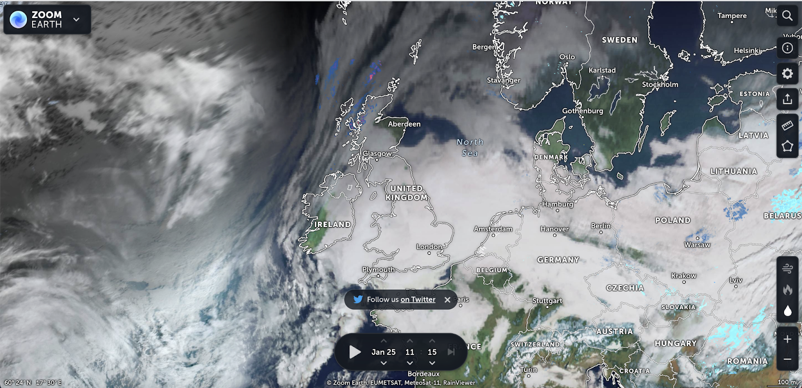
Zoom Earth - https://zoom.earth/
Zoom Earth provides live satellite imagery, which includes optional rain radar and animated wind speed maps. Zoom Earth is particularly useful for tracking live weather like hurricanes and wildfires. Using the data bar at the bottom of the map, users can navigate satellite imagery to view recent and historic data.
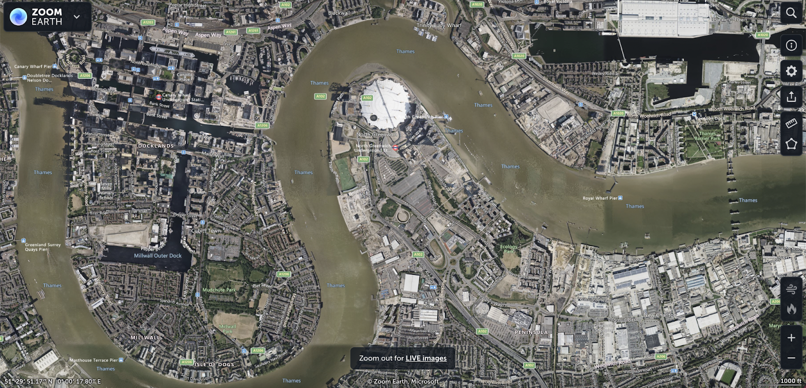
Scrolling in on the map to street level, the imagery provided stops being live imagery and Zoom Earth instead presents the latest version of available imagery from Microsoft.
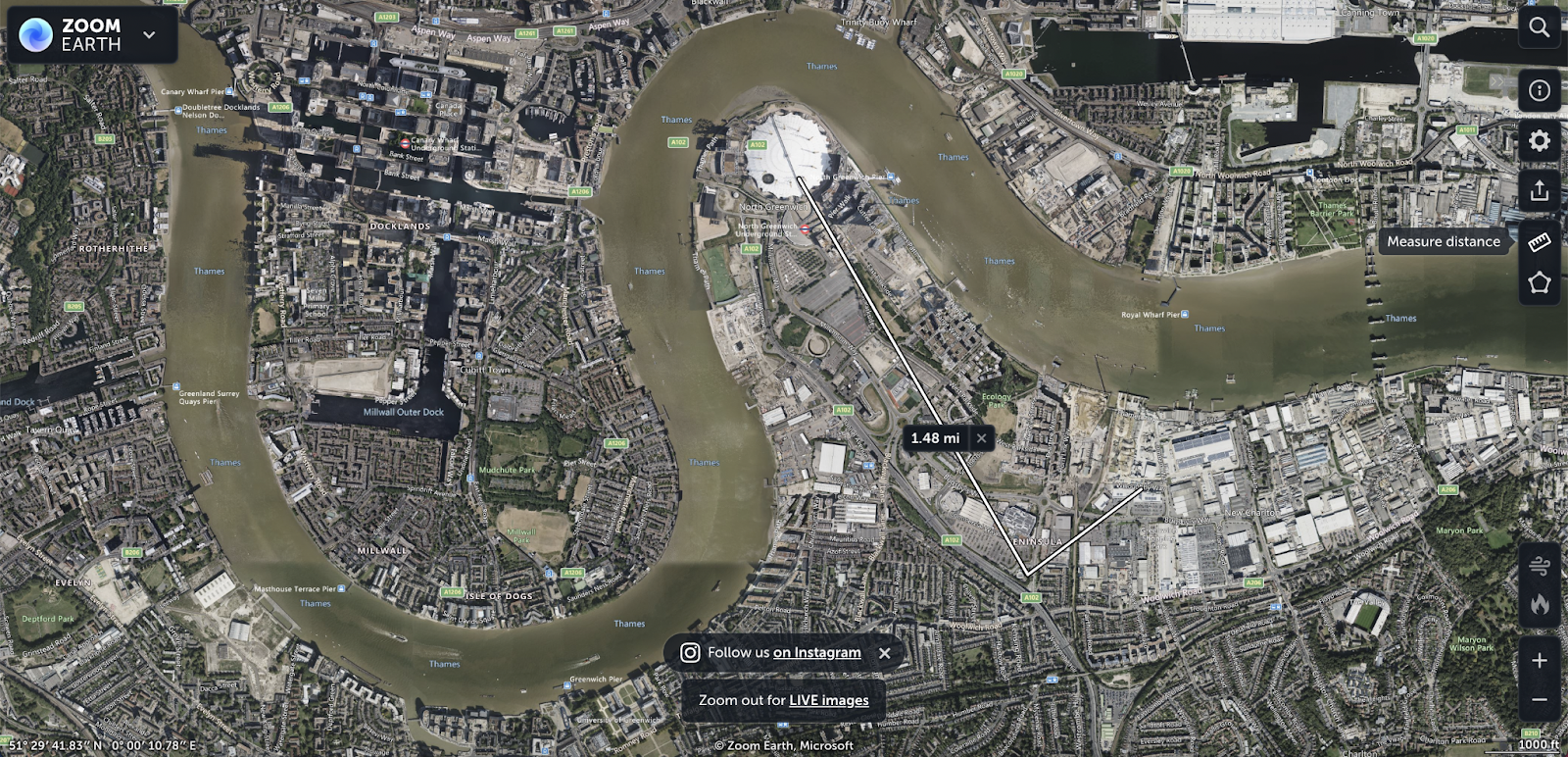
Using the ‘Measure distance’ ruler button on the right-hand menu, users can draw lines on the map to calculate distances. Multiple lines can be calculated together, calculating the final distance by double-clicking on the screen.
This is an introduction to geospatial OSINT Investigations. To view the full webinar, click here. To download the guide, which includes advanced techniques and analysis, click here.
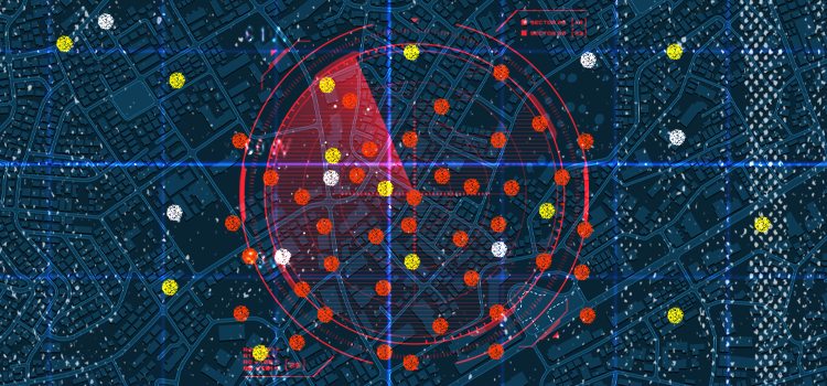
Automating your Geospatial OSINT Investigations
Using a tool like Skopenow, you can automate the processes outlined in this article to extract and analyze geospatial data. Skopenow instantly and anonymously locates and archives geospatial data from consumer data, social media posts and images, and web articles. Skopenow presents captures geospatial data in an interactive heat map, which will save you time organizing and interpreting the analyzed location intelligence. Please reach out to sales@skopenow.com or visit www.skopenow.com/try to schedule a demo and activate a 7-day free trial for qualified businesses.